Commercial Surveying Services
Technical Due Dilligence
Dilapidations Advice Representing Landlord or Tenant
Dilapidations Advice Representing Landlord or Tenant

Our technical expertise enables us to deliver technical due diligence surveys which provide a clear, holistic understanding of a property’s condition, compliance, and suitability. By combining detailed building analysis with practical commercial insight, we identify risks, quantify liabilities, and highlight opportunities to protect investment value. Each report is structured to support informed decision making, anticipate future expenditure, and give clients clarity, certainty, and confidence throughout acquisition or disposal of the asset.
Dilapidations Advice Representing Landlord or Tenant
Dilapidations Advice Representing Landlord or Tenant
Dilapidations Advice Representing Landlord or Tenant

Our team of dilapidations experts can help both investors and occupiers on understanding their lease obligations, manage risk and achieve effective outcomes at every stage of the lease.
Our dilapidations services include:
- Terminal schedules of dilapidations
- Negotiating settlements on behalf of both landlords and tenants
- Dilapidations assessments
- Exit strategy and recommendations
- Contract administration of works.
Party Wall Etc Act 1996
Dilapidations Advice Representing Landlord or Tenant
Planned Preventative Maintenance Plan (PPMP)

We provide a complete, end‑to‑end service for all matters arising under the Party Wall etc. Act 1996, ensuring compliance, clear communication, and a smooth process for both building owners and adjoining owners.
If you’re planning to build near a boundary, excavate close to a neighbouring property, or carry out work on a shared wall, the Act may apply.
We act for both parties, providing clear, impartial guidance and managing the statutory process from first notice through to final sign‑off.
Planned Preventative Maintenance Plan (PPMP)
Planned Preventative Maintenance Plan (PPMP)
Planned Preventative Maintenance Plan (PPMP)
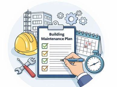
Our technical expertise enables us to deliver proactive maintenance planning focused on preserving building integrity, ensuring statutory compliance, and optimising long-term asset performance. Each schedule is tailored to anticipate future repairs, prioritise essential works, and align expenditure with strategic property objectives — providing clients with clarity, control, and confidence in their estate management.
Project Management/ Contract Administration
Planned Preventative Maintenance Plan (PPMP)
Project Management/ Contract Administration
.png/:/rs=w:388,h:291.72932330827064,cg:true,m/cr=w:388,h:291.72932330827064)
Our extensive experience allows us to offer hands on consultancy dedicated to helping deliver projects with robust specifications, targeted tendering based on quality to value requirements and proactive management during the construction phase.
Planning & Building Regulation Applications
Planned Preventative Maintenance Plan (PPMP)
Project Management/ Contract Administration

Our design capability enables us to guide clients from initial concept through to fully compliant planning and building regulation submissions. Our expertise ensure each application is well prepared, policy aligned and positioned for approval. This integrated approach provides clients with a smooth, informed pathway from early design decisions to authorised construction work.